In a significant scientific advancement with far-reaching implications for disaster management and environmental safety, the National Institute of Technology Karnataka NITK has developed a machine learning–based model to predict landslides in the Western Ghats. The initiative comes at a crucial time, as the ecologically sensitive mountain range continues to witness frequent landslides triggered by intense rainfall, deforestation, and changing climate patterns. Researchers involved in the project say the technology has the potential to save lives, reduce economic losses, and transform the way disaster preparedness is approached in vulnerable regions.
The Western Ghats, stretching across several States, are among the world’s most biodiversity-rich regions but are also highly prone to landslides, especially during the monsoon season. In recent years, landslides in Karnataka, Kerala, and parts of Maharashtra have claimed dozens of lives and caused widespread damage to homes, roads, and public infrastructure. Traditional landslide prediction methods have largely relied on historical data, rainfall thresholds, and manual surveys, which often fail to provide timely or location-specific warnings.
Against this backdrop, the work undertaken by NITK researchers represents a decisive shift toward data-driven, predictive disaster management. By leveraging machine learning algorithms, the team has created a system capable of analysing vast datasets related to rainfall, soil composition, slope angle, vegetation cover, and land-use patterns to assess landslide susceptibility with greater accuracy. The project underscores the growing role of artificial intelligence in addressing complex environmental challenges.
Researchers emphasised that the model is not designed to replace conventional geological assessments but to complement them by providing early warnings and probabilistic risk assessments. The technology can help authorities prioritise high-risk zones, plan evacuations, and deploy resources more effectively during extreme weather events. The development has been welcomed by disaster management officials and environmental experts, who see it as a crucial step toward proactive rather than reactive disaster response.
The project also highlights the expanding role of academic institutions in developing practical solutions to real-world problems. By applying advanced computational techniques to regional environmental challenges, NITK has demonstrated how research can directly contribute to public safety and policy planning, especially in climate-vulnerable regions like the Western Ghats.
Researchers involved in the project have also highlighted the importance of local calibration to improve the model’s effectiveness. The Western Ghats exhibit significant geological and climatic variation across districts, meaning that landslide triggers in one area may differ from another. By fine-tuning the algorithm with location-specific data, the system can provide more precise predictions, reducing false alarms and increasing trust among authorities and local communities.
Collaboration with State disaster management authorities is expected to be the next critical step. NITK scientists have indicated that pilot implementations could be carried out in highly vulnerable districts during upcoming monsoon seasons. Such pilots would allow real-world testing of the model’s predictive capabilities, helping refine alert thresholds and response protocols before wider deployment across the region.
Community engagement has also been identified as a crucial component of effective landslide prediction and response. Researchers stress that technological warnings must be accompanied by public awareness and preparedness measures. Local residents need to understand the meaning of risk alerts and the actions required when warnings are issued, ensuring that scientific predictions translate into life-saving behaviour on the ground.
Experts note that the integration of machine learning into disaster prediction also raises questions about data governance and responsibility. Ensuring accuracy, accountability, and timely dissemination of alerts will be essential to prevent panic or complacency. Authorities will need clear protocols defining how predictions are communicated, who issues official warnings, and how uncertainty in forecasts is explained to the public.
The initiative has also sparked interest among policymakers who view it as a potential model for evidence-based decision-making. By grounding disaster preparedness in scientific analysis rather than ad hoc judgment, such systems can strengthen institutional credibility and reduce political blame during natural calamities. Analysts suggest that this approach could mark a shift toward more transparent and data-driven governance in disaster-prone regions.
Ultimately, the NITK project reflects a broader transformation in how societies confront natural hazards. As climate change intensifies rainfall patterns and increases geological instability, reliance on traditional methods alone may no longer suffice. The use of machine learning to anticipate landslides signals a forward-looking strategy, where technology augments human expertise to build resilience, protect lives, and safeguard fragile ecosystems like the Western Ghats.
How Machine Learning Is Transforming Landslide Prediction
The machine learning model developed at NITK is based on the analysis of multi-dimensional data collected over several years. Researchers compiled extensive datasets that included rainfall intensity and duration, soil moisture levels, geological formations, slope gradients, land cover changes, and human interventions such as road cutting and construction activity. These variables were fed into supervised learning algorithms to identify patterns associated with past landslide events.
According to the research team, one of the major advantages of machine learning lies in its ability to handle complex, non-linear relationships between multiple factors. Landslides are rarely caused by a single trigger; instead, they result from a combination of natural and human-induced factors. Machine learning algorithms can identify subtle correlations that may be overlooked in traditional statistical models, improving predictive accuracy.
The model was trained using historical landslide data from different parts of the Western Ghats, including regions that have experienced repeated slope failures. By learning from these past events, the system can assign risk scores to specific locations under given weather and environmental conditions. These risk scores indicate the probability of a landslide occurring within a defined time frame.
Researchers noted that the system has undergone multiple validation tests to ensure reliability. Preliminary results have shown encouraging levels of accuracy, particularly in identifying high-risk zones during periods of intense rainfall. The model’s performance improves as more data is added, making it adaptable and scalable for long-term use.
Another key feature of the system is its ability to integrate real-time data. Rainfall information from weather stations and satellite inputs can be continuously fed into the model, allowing dynamic updates to risk assessments. This capability is critical for issuing timely alerts during extreme weather events, when conditions can change rapidly.
The researchers also focused on ensuring that the model’s outputs are understandable to non-technical users. Risk maps generated by the system visually highlight vulnerable areas, making it easier for district administrations, disaster response teams, and local authorities to interpret the findings and take action. This emphasis on usability is seen as essential for translating scientific innovation into practical governance tools.
Implications for Disaster Management and Regional Safety
The introduction of machine learning–based landslide prediction has significant implications for disaster preparedness in the Western Ghats. One of the most immediate benefits is the potential for early warning systems that can alert communities before a disaster strikes. Even a few hours’ advance notice can make a critical difference, enabling evacuations and reducing loss of life.
Disaster management authorities have expressed interest in integrating such predictive tools into existing monitoring frameworks. By combining machine learning outputs with ground-level observations and meteorological forecasts, officials can adopt a more targeted approach to risk mitigation. This could include temporary relocation of residents, closure of vulnerable roads, and pre-positioning of emergency response teams.
The technology could also play a role in long-term planning and policy formulation. Risk maps generated by the model can inform decisions on land-use zoning, infrastructure development, and environmental conservation. Areas identified as highly susceptible to landslides could be subject to stricter construction regulations, helping prevent future disasters caused by unplanned development.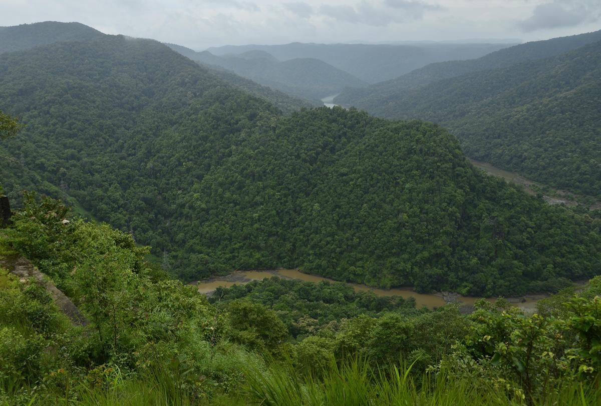
Environmental experts believe the initiative could strengthen arguments for sustainable development in the Western Ghats. By scientifically demonstrating how factors such as deforestation and slope modification increase landslide risk, the model provides evidence-based insights that can guide conservation efforts. This aligns with broader calls to balance development needs with ecological preservation in sensitive regions.
The project also has educational and capacity-building value. Students and researchers involved in the initiative gain hands-on experience in applying machine learning to environmental science, fostering interdisciplinary expertise. Such skill development is seen as essential for addressing future challenges linked to climate change and natural disasters.
Officials pointed out that while the model shows great promise, it must be continuously refined and supported by robust data collection systems. Expanding the network of weather stations, improving soil monitoring, and maintaining updated land-use records are crucial for sustaining predictive accuracy. Collaboration between academic institutions, government agencies, and local communities will be key to successful implementation.
Looking ahead, the NITK team aims to extend the model’s application beyond the Western Ghats. Similar approaches could be adapted for landslide-prone regions elsewhere in India, as well as for predicting other climate-related hazards such as floods and coastal erosion. Researchers believe that the integration of artificial intelligence into disaster management is no longer optional but essential in an era of increasing climate volatility.
In conclusion, NITK’s use of machine learning to predict landslides in the Western Ghats represents a powerful convergence of technology, science, and social responsibility. By transforming complex environmental data into actionable insights, the initiative offers hope for safer communities and more resilient landscapes. As climate risks intensify, such innovations stand as a reminder that intelligent planning and technological foresight can play a vital role in protecting both people and the environment, turning research into a shield against nature’s most unpredictable threats.
Follow: Karnataka Government
Also read: Home | Channel 6 Network – Latest News, Breaking Updates: Politics, Business, Tech & More
