November 30 Morning Forecast Places Cyclone Ditwah Closer to Tamil Nadu Coast
November 30 morning has become the central point of focus as Cyclone Ditwah strengthens near coastal Sri Lanka and the southwest Bay of Bengal. The system has already brought heavy rain to several regions of Tamil Nadu, and its movement toward the North Tamil Nadu–Puducherry–south Andhra coastline has increased caution among residents and authorities. According to early updates, the cyclone is moving at a steady pace of around 8 kmph in a north-northwest direction, signalling a gradual yet concerning approach.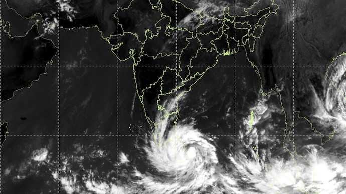
The impact is already visible in the form of continuous rainfall, rising winds, and increasing alerts. The Regional Meteorological Centre has issued a red alert for Thanjavur, Tiruvarur, Nagapattinam, and Mayiladuthurai until the expected landfall period. These districts are likely to experience the most intense phase of the cyclone due to their proximity to the projected path. Meanwhile, nearby regions are seeing shifting weather patterns that indicate strong outer-band activity.
Chennai and other neighbouring districts are under an orange alert, signalling heavy rainfall and strong winds. The city has already witnessed changes in cloud movement and short bursts of intense showers, suggesting that the system’s influence is expanding rapidly. As the cyclone continues to strengthen while moving over the sea, experts are closely monitoring shifts in its direction and intensity.
November 30 Morning Projection Brings High Alerts as Authorities Prepare for Worsening Weather
The November 30 morning projection has pushed authorities into active preparation. The issued alerts reflect the potential severity of the cyclone, with local administrations in coastal districts advised to prepare for flooding, strong winds, and disruptions. Emergency teams are on standby, and public advisories emphasize staying indoors, avoiding coastal areas, and following instructions from officials.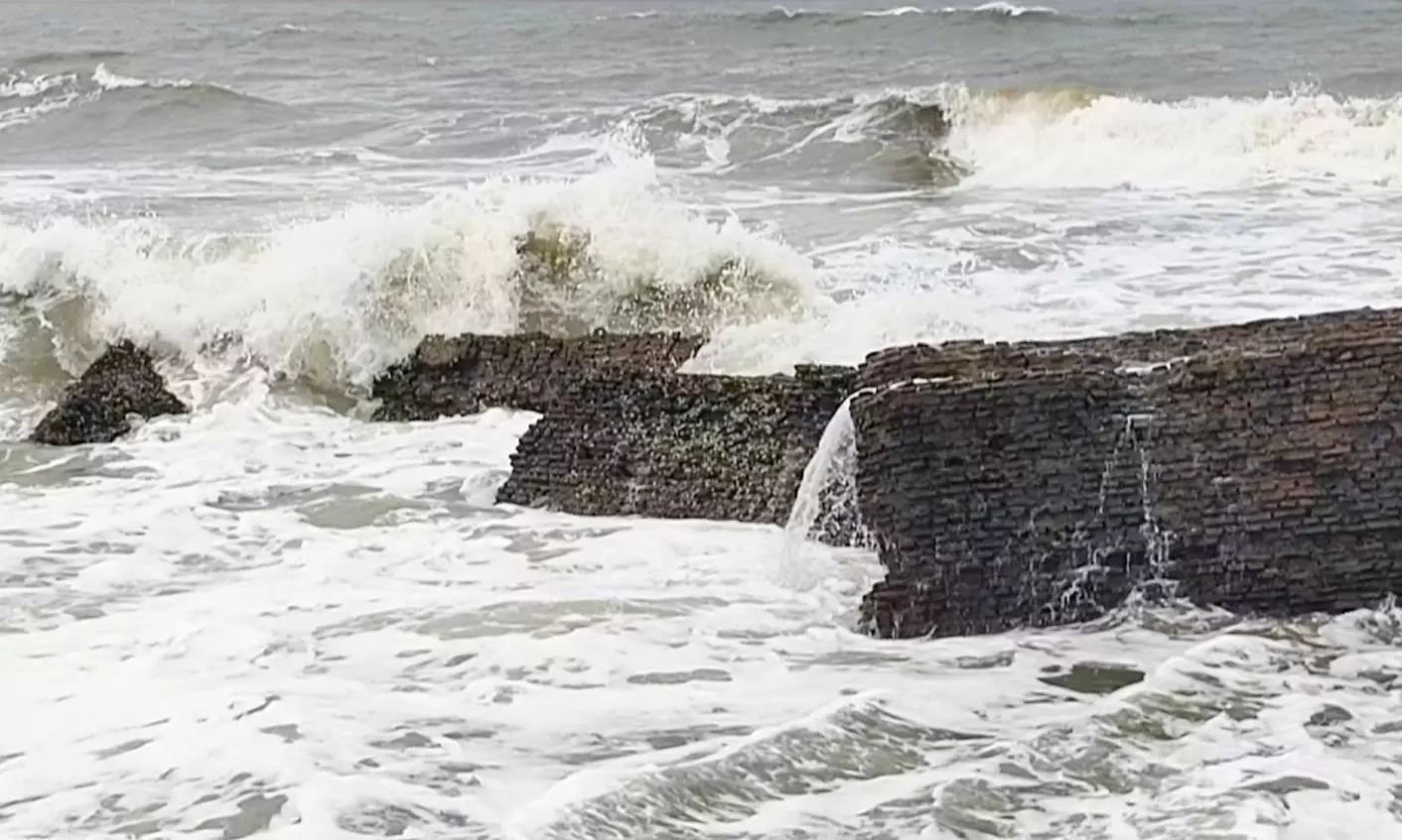
The movement pattern of the cyclone toward the Tamil Nadu–Puducherry belt indicates that the system is likely to bring heavy to very heavy rainfall. Even before its arrival, several districts have reported waterlogging in low-lying areas, signalling the level of saturation in the ground. The slow movement of the cyclone also increases the risk of prolonged rain, which may worsen the situation over the next two days.
Transport services and daily routines are expected to see changes as weather conditions intensify. Fishermen have been strongly advised not to venture into the sea due to rough waves and strong currents. Authorities in vulnerable districts have begun inspecting shelters and ensuring readiness for temporary relocation if needed. Electricity services, tree falls, and roadblocks are among the common challenges expected during such weather events.
As the system approaches, there is also a rising concern about river levels and drainage systems. The combination of strong rainbands and slow cyclone movement could place additional pressure on water bodies. Preparations are underway in multiple districts to manage overflow risks and ensure that emergency responses remain smooth if situations escalate.
November 30 Morning Path Prediction Shows Expanding Rainfall Across Key Regions
With the November 30 morning arrival window, the rainfall pattern across Tamil Nadu has shown gradual expansion. The coastal districts are receiving the first phase of the cyclone’s effect, but interior regions are also seeing changes. The presence of thick clouds and strong winds indicates that the system is strengthening while drawing moisture from the Bay of Bengal.
The steady wind flow suggests that the cyclone may continue to build intensity before nearing the coast. While its exact strength upon arrival is still being monitored, the rainfall distribution so far highlights the possibility of widespread impact. Residents are being urged to take precautions, especially during late-night and early-morning hours when visibility is low and conditions can worsen suddenly.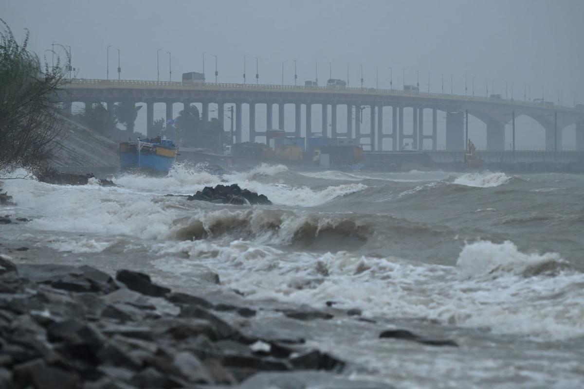
Chennai and surrounding districts such as Tiruvallur, Chengalpattu, and Kancheepuram are preparing for a notable increase in rainfall. The combination of urban settlement and expected heavy showers raises concerns about water stagnation and traffic disruptions. The movement of the cyclone, even at its current speed, has already caused uneven rain patterns across these regions.
November 30 Morning Approach of Cyclone Ditwah Keeps Residents Alert
The anticipation of November 30 morning has created a sense of caution among residents across Tamil Nadu. People are being advised to stay updated with reliable weather reports and avoid unnecessary travel. Local authorities are working to ensure that essential services remain functional while preparing for potential interruptions.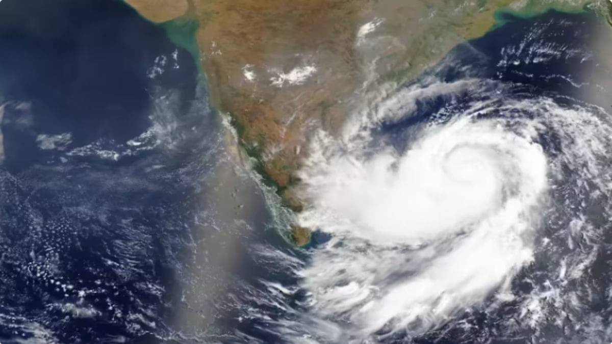
The cyclone’s approach has also prompted warnings about strong gusts and possible damage to weak structures. Coastal villages are particularly under focus as the combination of wind, rain, and rising tides poses additional challenges. The movement and strength of the cyclone in the final hours before reaching the coast will determine how intense the impact becomes. Also Read: Cyclone Ditwah: Devastating Storm Claims 46 Lives in Sri Lanka
Residents in both rural and urban areas are being encouraged to keep emergency supplies ready and stay indoors during heavy spells. As the weather continues to shift, the emphasis remains on safety and readiness until clear updates confirm the cyclone’s weakening or passage beyond the region.
Conclusion
The November 30 morning timeline marks a critical period as Cyclone Ditwah moves closer to the Tamil Nadu–Puducherry coast. With alerts issued, rainfall increasing, and authorities preparing for possible complications, residents are urged to stay cautious and follow official guidance until conditions improve.
