The Bruhat Bengaluru Solid Waste Management Limited has cited satellite imagery to assert that several families living near waste processing zones are recent occupants, a claim that has triggered strong opposition from residents who insist they have lived there for years. The dispute has emerged amid eviction notices issued as part of a wider drive to clear what authorities describe as unauthorised habitations on public land. While officials argue that satellite data offers objective evidence, affected families say the reliance on remote imagery ignores lived histories, local records, and the socio-economic realities of informal settlements in a rapidly expanding city.
The episode has also intensified scrutiny of how public agencies communicate technological findings to affected communities. Residents argue that satellite images and analytical conclusions were never properly explained to them in accessible terms, deepening mistrust. Experts in public administration note that transparency is not only about making data available but also about ensuring that people understand how decisions affecting their lives are reached. Without such clarity, even accurate data risks being perceived as arbitrary or hostile.
There are growing calls for the establishment of independent review committees comprising urban planners, legal experts, social workers, and community representatives. Such bodies, activists argue, could examine disputed cases where satellite data and residents’ claims diverge, ensuring a balanced assessment. They believe this would introduce an element of procedural fairness, reducing the likelihood of wrongful evictions while still allowing authorities to enforce environmental and planning regulations where genuinely necessary.
The dispute has also caught the attention of elected representatives, some of whom have begun engaging with both BSWML officials and affected families. While responses have varied, a few leaders have urged the administration to adopt a rehabilitation-first approach, especially where long-term residence can be reasonably established. They argue that governance should prioritise humane outcomes over rigid enforcement, particularly in cases involving economically vulnerable groups.
Urban sociologists observe that such conflicts are likely to become more frequent as cities increasingly rely on digital tools for land management. While these technologies can improve efficiency, they caution that over-reliance may erode the role of local knowledge and community memory. Cities like Bengaluru, they note, are layered with histories that cannot always be neatly captured through technological snapshots.
For the families involved, the uncertainty continues to cast a shadow over daily life. Children attend school not knowing whether their homes will still stand when they return, while adults hesitate to invest even in basic repairs. This state of limbo, residents say, is emotionally draining and economically destabilising, reinforcing their plea for timely and compassionate resolution.
As Bengaluru charts its future as a technology-driven metropolis, the outcome of this dispute will carry symbolic weight. It will indicate whether digital governance can coexist with social justice or whether efficiency will override empathy. The choices made now will not only determine the fate of these families but also shape public confidence in how technology is used to govern the city’s most vulnerable residents.
BSWML officials have maintained that high-resolution satellite images, analysed over different time periods, show no permanent structures at the locations in question until recently. According to the agency, this indicates fresh encroachments that cannot be regularised under existing policies. The findings, officials say, were part of an internal assessment aimed at ensuring compliance with environmental norms and preventing further pressure on waste management infrastructure. They argue that unchecked habitation near landfills and processing units poses health and safety risks not only to residents but also to the city at large.
Families facing eviction, however, have strongly disputed these claims, calling them inaccurate and misleading. Many residents insist they have lived in the area for over a decade, producing ration cards, voter identity documents, electricity bills, and school records to support their case. They argue that satellite images fail to capture incremental housing development, such as temporary shelters gradually converted into permanent homes, a common pattern in informal settlements. For them, the issue is not merely about land ownership but about recognition, dignity, and the right to be heard.
Residents also allege that the sudden invocation of satellite data reflects a selective approach to enforcement. They point out that informal settlements across Bengaluru have existed for decades with tacit administrative acceptance, only to face eviction when land values rise or infrastructure projects are proposed. In this context, the use of satellite imagery is seen by many as a convenient tool to justify displacement rather than a neutral instrument of governance.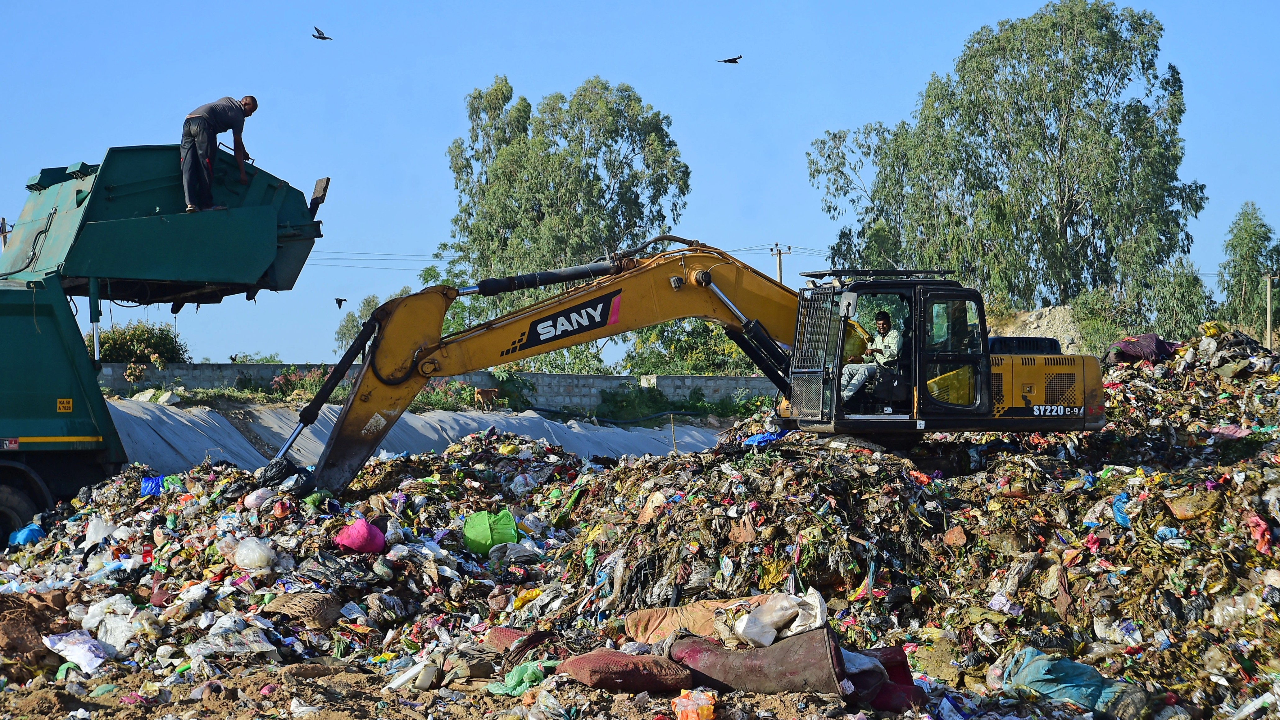
Disputed Evidence and Administrative Standpoints
Officials defending the BSWML’s position argue that satellite data provides an unbiased, time-stamped record that reduces dependence on potentially manipulated local documents. They claim that traditional proofs such as ration cards or electricity connections can be obtained even without legal land tenure, making them unreliable indicators of lawful occupation. Satellite imagery, they say, allows authorities to establish a clearer timeline of settlement growth and identify recent encroachments that violate environmental and planning regulations.
The agency has also stressed that its actions are guided by statutory responsibilities. Waste processing zones, officials note, are governed by strict buffer norms intended to protect public health and ensure smooth operations. Any new habitation within these zones, they argue, compromises safety and hampers waste management activities. From this perspective, clearing recent encroachments is framed as a regulatory necessity rather than an administrative choice.
However, urban planners and legal experts caution against treating satellite data as conclusive evidence in isolation. They point out that while remote sensing is a powerful tool, it must be interpreted alongside ground-level verification. Factors such as tree cover, roofing materials, and seasonal variations can affect image clarity, potentially leading to misinterpretation. Experts argue that relying solely on satellite imagery without comprehensive field surveys risks administrative errors with severe human consequences.
Civil rights groups have echoed these concerns, warning that technology-driven governance can become exclusionary if not tempered with social sensitivity. They argue that informal settlements often evolve invisibly, with structures blending into the landscape in ways that may not be immediately apparent in aerial images. For residents, the absence of early satellite visibility does not negate years of residence, community formation, and contribution to the city’s economy.
The dispute has also raised questions about due process. Families allege that eviction notices were issued without adequate consultation or opportunity to challenge the satellite-based findings. They argue that meaningful hearings, transparent sharing of data, and independent verification should precede any action that threatens livelihoods and shelter. Without such safeguards, they fear that technological evidence could override constitutional protections.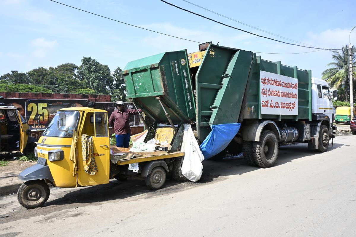
Lives, Livelihoods, and the Question of Justice: Bengaluru
Beyond the technical debate lies a deeper human story of vulnerability and survival. Many of the affected families depend on informal employment linked to the city’s waste economy, construction sector, or domestic work. Proximity to their workplaces, they say, reduces travel costs and enables precarious livelihoods. Eviction would not only displace them physically but also disrupt fragile economic networks built over years.
Women residents have expressed particular anxiety about displacement, citing concerns over safety, access to schools, and healthcare. For them, relocation to distant sites often translates into longer commutes, loss of income opportunities, and increased domestic burdens. Community elders also fear the erosion of social support systems that have evolved within the settlement, including shared childcare and mutual aid during crises.
Activists argue that the conflict reflects a broader failure to address affordable housing in Bengaluru. As land prices soar and formal housing remains out of reach for low-income groups, informal settlements become the only viable option. They contend that eviction drives, justified through technological assessments, treat symptoms rather than root causes. Without inclusive housing policies, they warn, displacement will continue to reproduce vulnerability elsewhere in the city.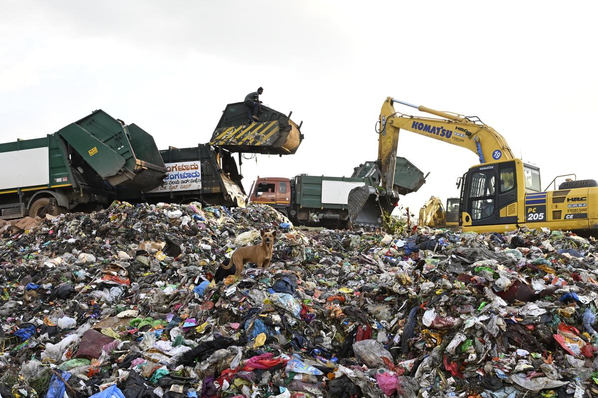
The role of satellite data in governance has thus become a focal point of debate. While technology promises efficiency and objectivity, critics argue that it must be embedded within a framework of social justice. Data, they say, does not exist in a vacuum and must be contextualised within historical, economic, and human realities. Otherwise, there is a risk of reducing complex lives to pixels on a screen.
Officials, for their part, insist that they are open to reviewing grievances through appropriate channels. Some have indicated that representations from residents will be examined, and additional verification may be conducted where discrepancies arise. However, families remain sceptical, citing past experiences where assurances did not translate into relief on the ground.
As the standoff continues, the issue has attracted wider public attention, prompting debates on urban governance, technological authority, and the rights of the urban poor. The outcome will likely set an important precedent for how data-driven tools are deployed in sensitive contexts involving displacement. Whether satellite imagery becomes an unquestioned arbiter of legality or one component in a more humane decision-making process remains to be seen.
Ultimately, the conflict underscores a central challenge facing Indian cities: balancing regulation and development with empathy and inclusion. For the families contesting the BSWML’s claims, the fight is not just about land but about recognition of their existence and contribution. As Bengaluru grapples with growth and governance, the resolution of this dispute will signal whose voices matter when technology and human lives intersect.
Follow: Karnataka Government
Also read: Home | Channel 6 Network – Latest News, Breaking Updates: Politics, Business, Tech & More
