Mysuru has taken a significant step toward strengthening its urban environmental management with the mapping of 48,000 trees as part of a comprehensive city-wide tree audit. The initiative, undertaken by civic authorities in collaboration with environmental experts, marks one of the most detailed documentation exercises of urban greenery in the region. Officials say the audit is designed to create an accurate database of tree species, health conditions, age patterns, and distribution across neighbourhoods. The effort is expected to guide future conservation, urban planning, and climate resilience strategies in a city already known for its green heritage.
Civic administrators explained that the mapping exercise uses digital tools, including geographic tagging and mobile-based data collection, to ensure precision. Each tree recorded in the survey is assigned a unique identification number, along with details such as species name, trunk girth, canopy spread, and visible signs of disease or damage. Survey teams comprising horticulture staff and trained volunteers have been moving ward by ward, ensuring systematic coverage. The process, officials said, also helps identify areas where tree cover is thinning, enabling targeted plantation drives to maintain ecological balance.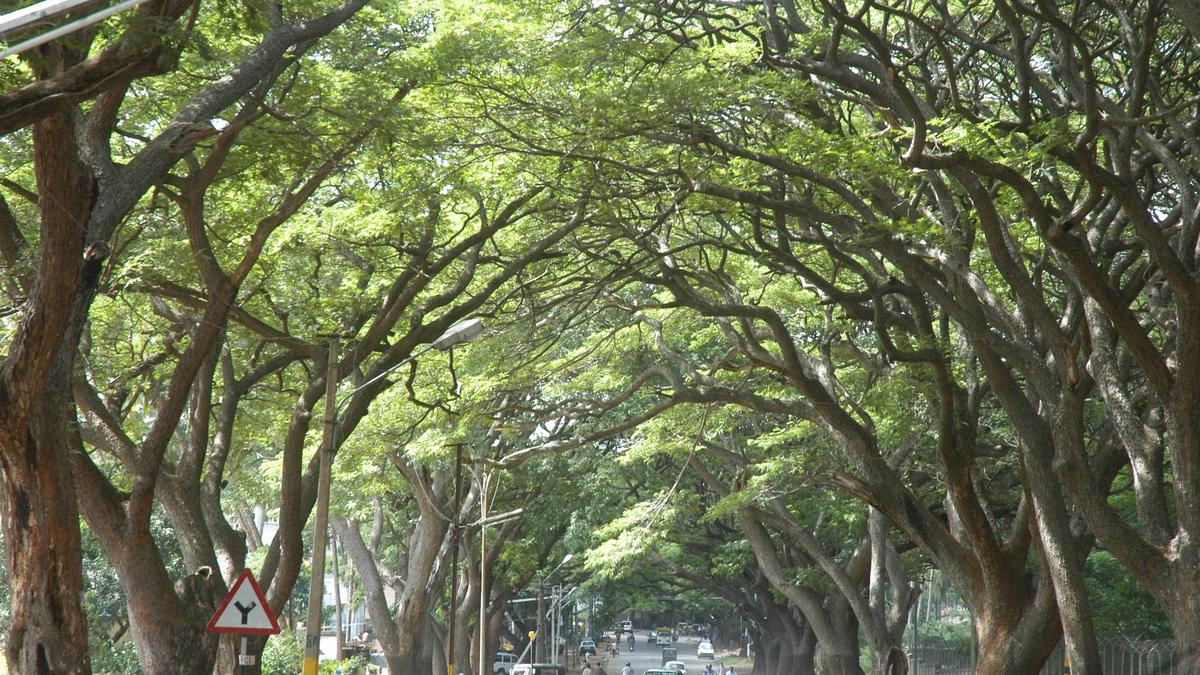
Mysuru’s reputation as a garden city has long been associated with its broad avenues, heritage parks, and institutional campuses lined with mature trees. However, rapid urbanisation, road widening projects, and construction pressures have raised concerns about the gradual decline of green cover. Environmentalists have repeatedly emphasised the need for reliable data to support preservation efforts. The current audit addresses that gap by creating a scientific baseline, which can be referred to during infrastructure planning, ensuring that tree removal is minimised and compensatory planting is evidence-based rather than symbolic.
The audit has also prompted discussions about legal protections for urban trees. Environmental regulations already require permissions for felling, but enforcement often depends on clear documentation. With each tree now geo-tagged and recorded, monitoring becomes more practical. Authorities can verify whether removals are authorised and ensure compensatory planting meets prescribed norms. Transparent records reduce disputes and strengthen public trust in civic processes. Legal experts suggest that such databases could eventually support policy refinements, ensuring that urban greenery is treated as protected civic infrastructure rather than an expendable resource during development projects.
Another dimension emerging from the exercise is the potential for disaster preparedness. Strong winds and heavy rains occasionally lead to tree falls, disrupting traffic and damaging property. Data on tree age, structural condition, and species characteristics can help predict vulnerability. Preventive pruning and soil stabilisation can be prioritised for high-risk areas. This proactive approach enhances public safety while preserving healthy specimens. Urban forestry specialists note that understanding tree biomechanics and site conditions through structured data is more effective than reactive responses after damage has already occurred.
The initiative is also expected to influence future plantation strategies. Rather than planting saplings randomly, planners can now identify gaps in canopy cover and design green corridors that connect parks, lakes, and residential areas. Such ecological networks support wildlife movement and improve microclimates. Targeted planting in heat-prone zones may reduce urban heat island effects. By aligning plantation drives with audit findings, the city can move from symbolic greening efforts to scientifically informed expansion of green infrastructure that delivers measurable environmental benefits.
Youth engagement has gained momentum through the audit process. Educational institutions participating in awareness programmes have incorporated urban ecology topics into activities and projects. Students learning to identify tree species and understand their ecological roles develop early appreciation for environmental stewardship. Civic officials believe that nurturing this awareness fosters long-term behavioural change, encouraging responsible attitudes toward public spaces. As young residents see their local environment documented and valued, they are more likely to support conservation initiatives in the future.
Looking ahead, experts suggest that Mysuru’s tree database could integrate with broader environmental monitoring systems. Linking tree data with information on air quality, rainfall, and land use patterns would create a comprehensive urban sustainability framework. Such integration can guide evidence-based decisions across sectors, from transport planning to public health policy. The tree audit thus represents more than an environmental survey; it is a foundational step toward holistic urban governance where natural assets are recognised as central to resilience, well-being, and sustainable growth.
Officials noted that climate considerations played a major role in launching the audit. Rising temperatures and erratic rainfall patterns have highlighted the cooling and water-retention functions of urban trees. Shade from large canopies reduces surface heat, while root systems improve soil permeability. By mapping existing trees, authorities can better understand which zones offer natural climate buffers and which require additional green interventions. Such data-driven planning is increasingly seen as essential for cities facing the dual challenges of growth and environmental stress.
The project has also opened avenues for community engagement. Residents are encouraged to report missing or damaged trees through designated channels, complementing official surveys. Schools and colleges have been invited to participate in awareness activities, linking environmental education with practical civic action. Organisers believe that involving the public will foster a sense of ownership toward urban greenery, making conservation a shared responsibility rather than solely a municipal function.
Technology and Data Shaping Urban Ecology
The adoption of digital tools in the Mysuru tree audit represents a shift toward modern environmental governance. Field teams use handheld devices to upload information directly to a central database, reducing paperwork and improving accuracy. Geographic coordinates allow planners to visualise green cover patterns through mapping software. This layered data approach enables cross-referencing with infrastructure layouts, helping authorities assess how future projects may affect existing trees. Such integration of technology with ecology signals a broader trend toward evidence-based decision-making in urban management.
Experts involved in the exercise said that tree health assessment forms a crucial part of the audit. Visual indicators such as leaf condition, trunk integrity, and pest presence are recorded to identify specimens requiring care. Preventive measures like pruning, soil treatment, or pest control can then be prioritised. Early intervention not only preserves mature trees but also reduces risks of branch failure during storms. Maintaining tree health is considered more sustainable than frequent replanting, which takes years to recreate the ecological functions of established greenery.
Species diversity is another focus area. Mysuru’s tree population includes native varieties alongside ornamental and introduced species. Understanding this mix helps planners promote biodiversity and reduce vulnerability to disease outbreaks that may affect specific species. Environmentalists have long advocated for increasing native tree cover, which better supports local bird and insect populations. The audit’s species-level data provides a foundation for such targeted ecological planning, aligning urban landscaping with broader conservation goals.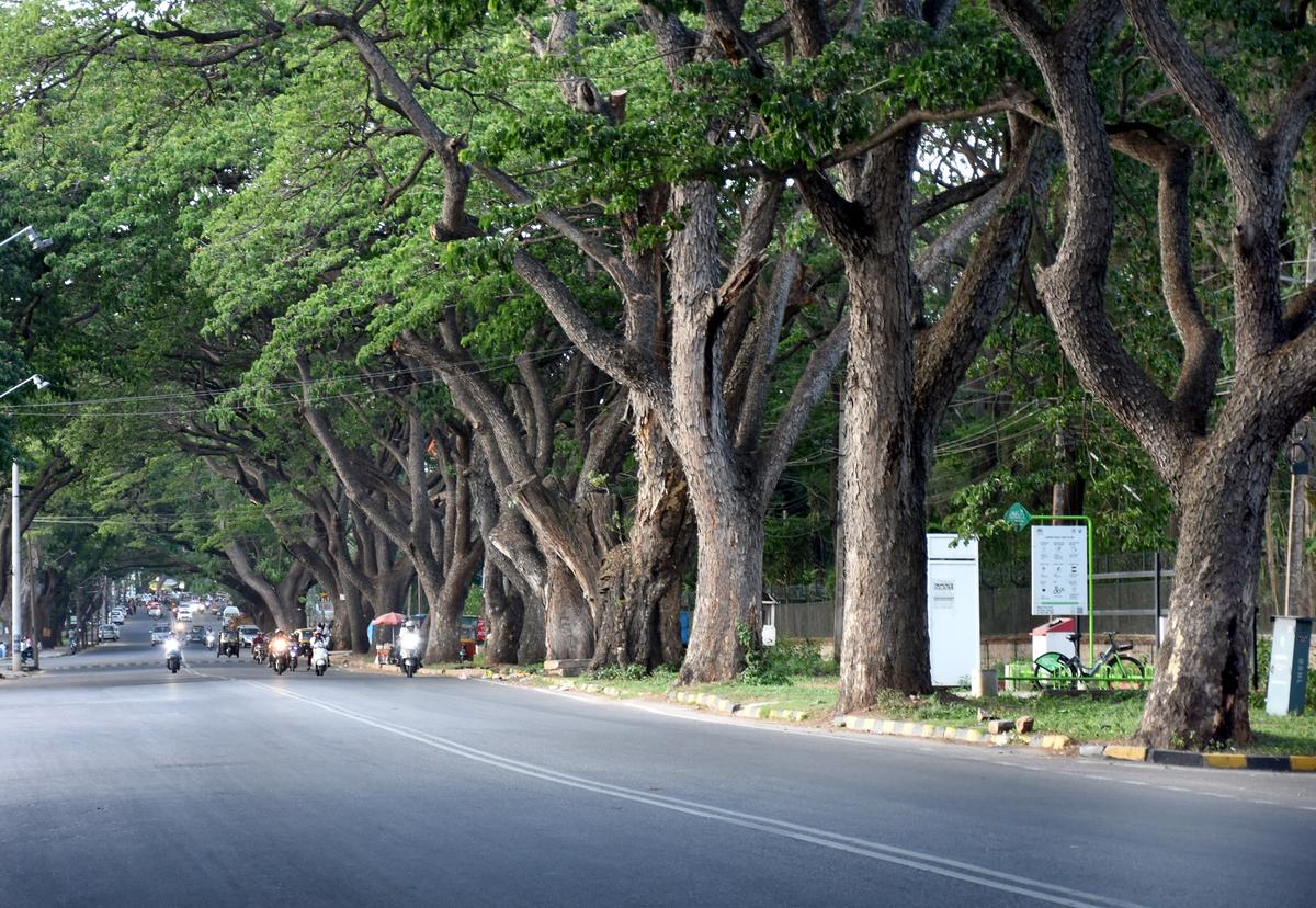
Urban planners emphasise that tree data can influence road design and utility planning. Knowing the location and root spread of large trees allows engineers to adjust alignment or protective measures during construction. This reduces conflicts between infrastructure expansion and environmental preservation. The availability of mapped data may also streamline the process of granting permissions for tree removal, ensuring transparency and accountability. Decisions can be backed by recorded evidence rather than ad hoc assessments.
The initiative has drawn attention from academic institutions interested in studying urban ecosystems. Researchers see potential in using the dataset to analyse correlations between green cover and air quality, heat islands, and biodiversity patterns. Such collaborations could generate insights extending beyond city limits, contributing to national discussions on sustainable urban development. Mysuru’s model may serve as a reference for other municipalities seeking to undertake similar audits.
Community, Climate, and the Future of Green Spaces
Public response to the audit has largely been positive, with many residents expressing pride in the city’s green assets. Citizen groups have organised neighbourhood walks to learn about local tree species, turning the exercise into an educational opportunity. Awareness that each tree is now documented has also created a sense of vigilance, discouraging unauthorised cutting. Community participation strengthens the social foundation of conservation, ensuring that data collection translates into long-term protection.
Climate resilience remains a central theme of the project. Trees play a vital role in absorbing carbon dioxide, moderating temperature, and supporting urban wildlife. As Mysuru expands, maintaining these ecological services becomes increasingly important. The audit provides a framework for measuring future changes in green cover, enabling authorities to track progress toward sustainability goals. Such monitoring is crucial in adapting to environmental uncertainties.
Financial planning may also benefit from the exercise. Maintaining urban trees involves resources for pruning, pest management, and replacement planting. Accurate data helps allocate budgets more efficiently, focusing efforts where they are most needed. Over time, preventive care informed by audit findings can reduce emergency costs associated with storm damage or tree failure. Thus, environmental stewardship aligns with fiscal prudence.
Civic leaders have indicated that the database will be updated periodically, ensuring that it remains relevant as the city evolves. New plantations will be added, and tree health records revised. Continuous monitoring transforms the audit from a one-time survey into an ongoing management tool. Such sustained attention reflects a growing recognition that urban greenery requires the same systematic oversight as other civic infrastructure.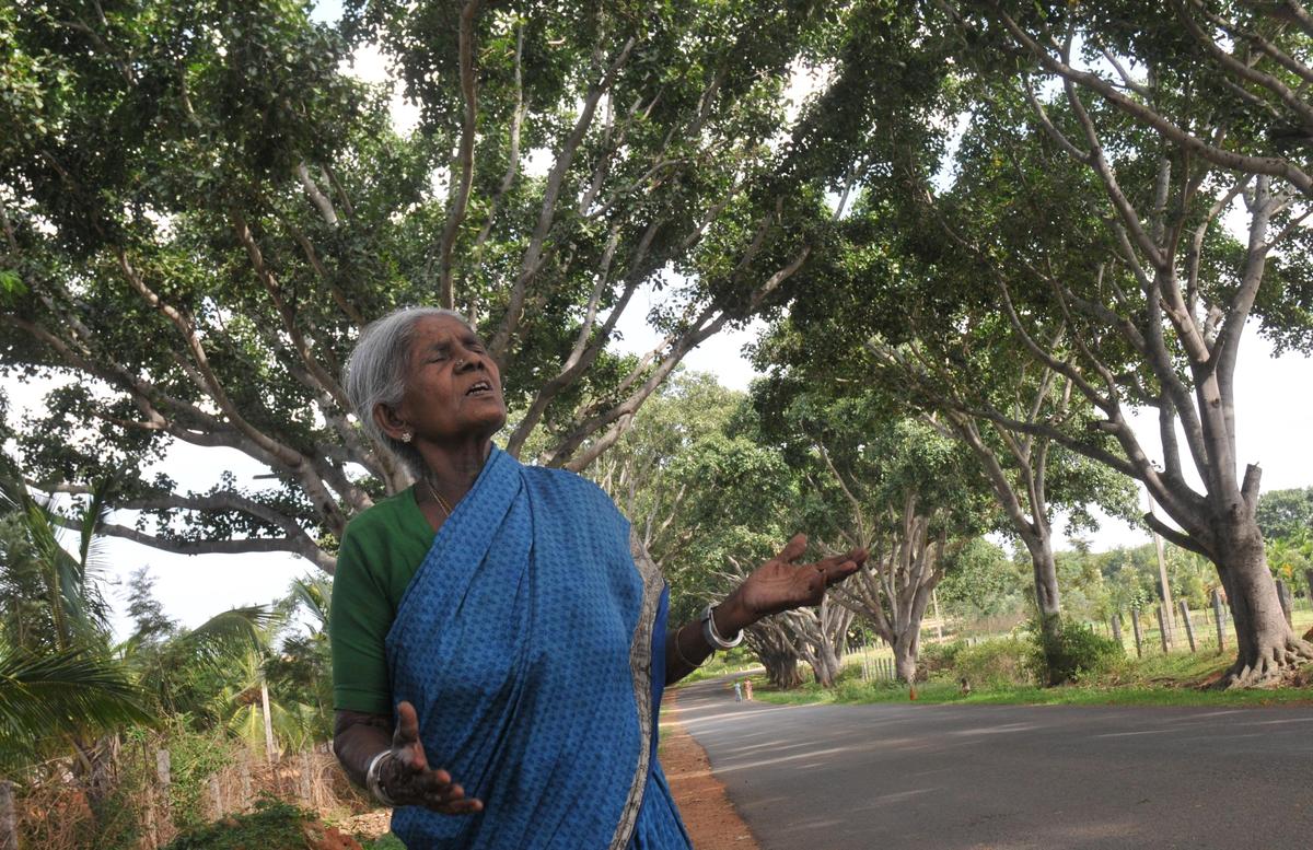
Environmental advocates hope that the initiative will inspire similar efforts in other cities facing rapid change. Urban trees, often taken for granted, are increasingly acknowledged as essential infrastructure. Documenting and protecting them is not merely an aesthetic concern but a public health and climate necessity. Mysuru’s detailed mapping of 48,000 trees demonstrates how cities can blend tradition with innovation, preserving their green identity while preparing for future challenges.
Ultimately, the audit underscores the value of viewing urban landscapes as living systems. Trees connect ecological, social, and economic dimensions of city life. By cataloguing and caring for its green assets, Mysuru signals a commitment to balanced development. The project stands as a hopeful example of how thoughtful planning, community involvement, and scientific tools can come together to safeguard nature within urban spaces, ensuring that future generations inherit a city where greenery continues to thrive alongside growth.
Follow: Karnataka Government
Also read: Home | Channel 6 Network – Latest News, Breaking Updates: Politics, Business, Tech & More
